
By Jeff Blackadar
Reposted from Digital History Learning Journal, January 9, 2021.
Over the course of history, geography changes. Places signified on maps at one time can lose significance. Place names change and new ones emerge. This post is about reading a 19th century map to collect place names and position them geographically so they can be plotted on maps from other time periods to gain insight.
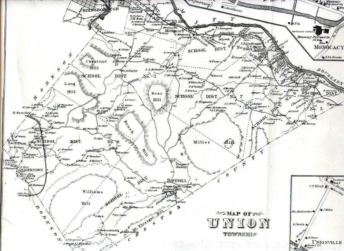
Below is a partial, georectified map of Union Township, Berks County Pennsylvania, 1876.[1]
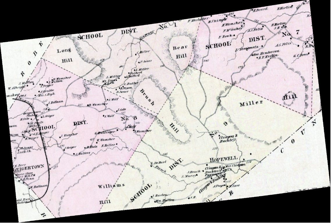
Microsoft’s Azure Cognitive Services can transcribe the text on the map, such as listed below. Dr. Shawn Graham documented how to set up Azure Cognitive Services. The python code I am using is linked at the end of the post.
H.Beard
F. Mostaller-
H.Hirtint
260
SCHOOL DIST.
H.Shingle
Eisprung
No. 1
A. Wamsher
... etc.
For each line of text Azure Cognitive Services recognizes on the map, Azure returns coordinates of a rectangle in the image where the text appears. Here is the map with an overlay of recognized text:

This map is a georectified tif provided by Dr. Ben Carter. Given we have pixel x,y coordinates for the image and know its geographic coordinate reference system is 32129 we can transform the image pixel coordinates into geographic ones and save them in a shapefile. The shapefile can then be plotted on other maps, like below:

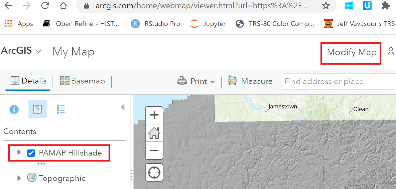
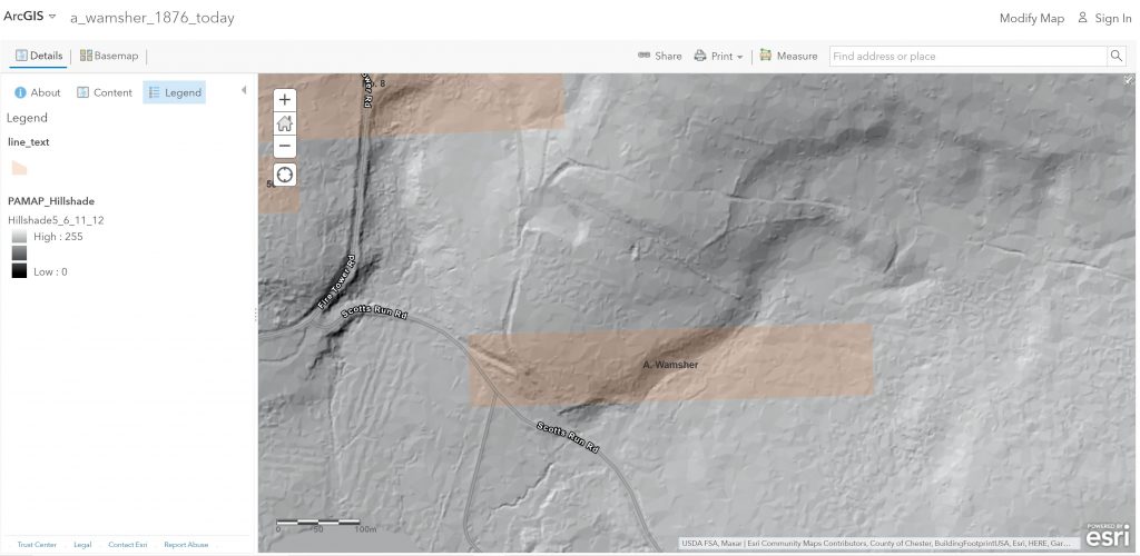
I also plotted the line_text shapefile on ArcGIS on-line map viewer. I clicked Modify Map and zoomed to the area of interest:
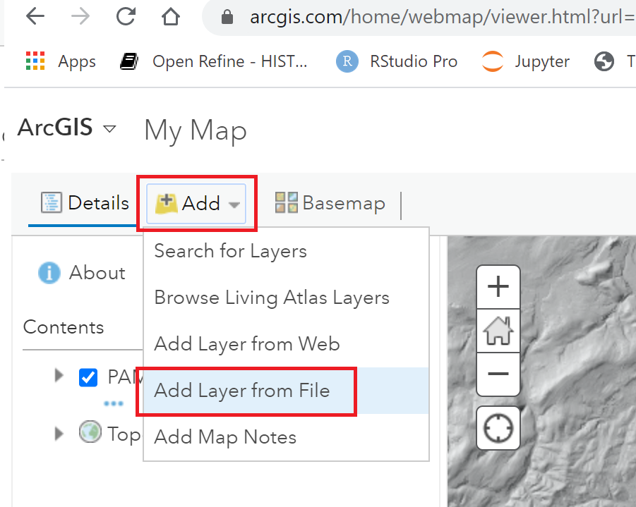
I clicked, Add | Add Layer from File and selected the zip of the line_text shapefile to import it. ArcGIS has options to set the color of polygons and display labels.

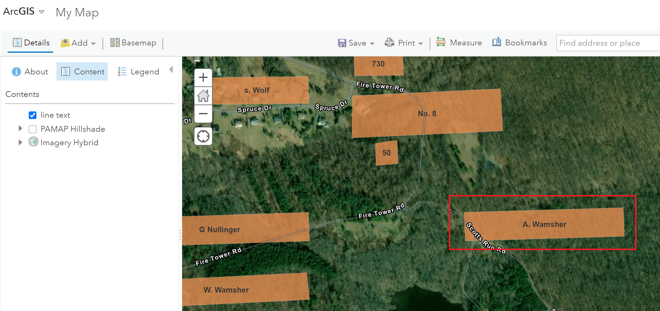
As seen above, some places labelled in 1876 are not immediately evident on current maps. The place labelled A. Wamsher likely was a farm. Today this area is within Pennsylvania’s French Creek State Park. It appears to be a forest, perhaps second-growth.
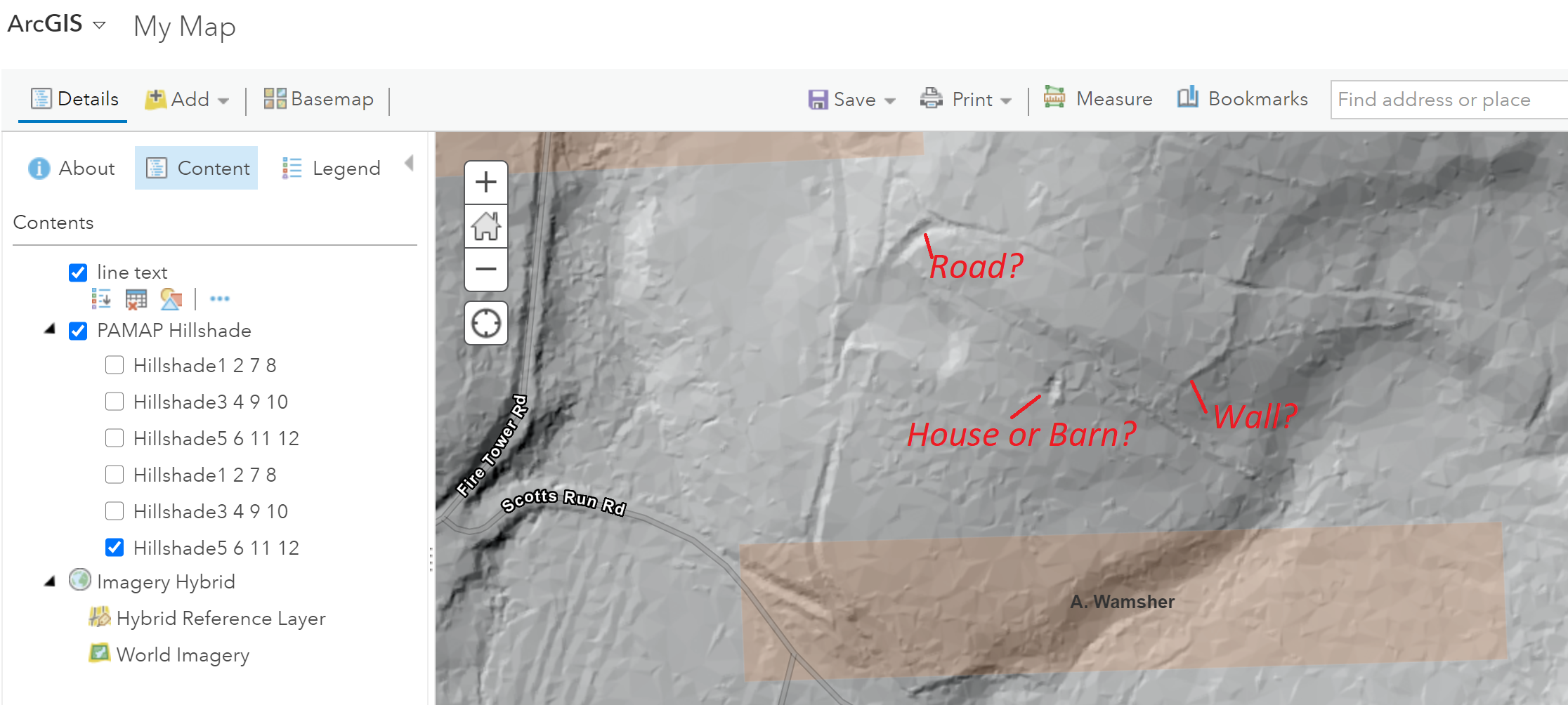
Adding PAMAP Hillshade shows additional features. It’s speculation, but are the ridges and depressions shown on the hillshade image remains of A. Wamsher’s farm?
Below is an embedded version of the map.
The python notebook is on GitHub.
Thank you to Dr. Ben Carter for the map and idea. I appreciate the support of the Computational Creativity and Archaeological Data and Computational Research on the Ancient Near East projects.
[1] Davis, F. A., and H. L. Kochersperger. 1876. Illustrated Historical Atlas of Berks County, Penna. Union Township. Reading [Pa.]: Reading Pub. House.
USGenWeb Archives has a full image.
Editor’s note: Jeff Blackadar is an MA student in the Department of History, Carleton University, specializing in Data Science. He is working towards his degree under the supervision of Prof. Shawn Graham.